![]()
|
|
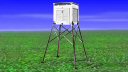
Get Involved!What's odd about these pictures? Forest Grove, OR
Marysville, CA
Tahoe City, CA
If you know anything at all about measuring temperature, you'll see that these sites above don't meet the basic criteria for scientifically valid observations. Yet, the data from these weather stations is part of the USHCN data set and is used by NASA to model climate, the IPCC to publish reports, and your government to make policy decisions. A hands-on photographic audit will help sort the good stations from the bad ones to improve the reliability of the data and conclusions drawn from it. If you have a digital camera, a portable handheld GPS device with accuracy within 100 feet or better, and the ability to follow simple instructions, you can contribute to this database. We have a growing online database of USHCN, GHCN, and GISS station site surveys on our high speed database server located at: SEE THE ONLINE DATABASE AT http://gallery.surfacestations.org Anyone can browse images and site surveys, if you'd like to participate and upload your own site surveys and photos, we ask that you signup. Registrations will be approved by the site adminsitrator. IMPORTANT: You must agree to be bound by the RULES FOR USE Pay particular to the area of respecting privacy and property rights of station locations and observers. Many weather stations are located on private or restricted property. Permission must be obtained from the site curator, property owner, or facilities manager before conducting any site survey. Instructions: How to find a USHCN station near you:
|
Your help is needed to document the measuring environment and equipment condition of weather and climate monitoring stations worldwide. Anyone with a digital camera, handheld GPS and and basic observation and reporting skills can contribute to this database. To get started, first signup, then view and/or download the instructions and site survey form from here of from the online image database at gallery.surfacestations.org Then familiarize yourself with them, and then choose what stations you want to survey and contribute to this database. Full credit is given to all contributors of photos and survey forms, or if you wish, you can submit a survey anonymously. All submissions will be checked for accuracy.
|


| © 2007, 2008, 2009 - surfacestations.org, Anthony Watts, and various contributors - see rules and terms of use |